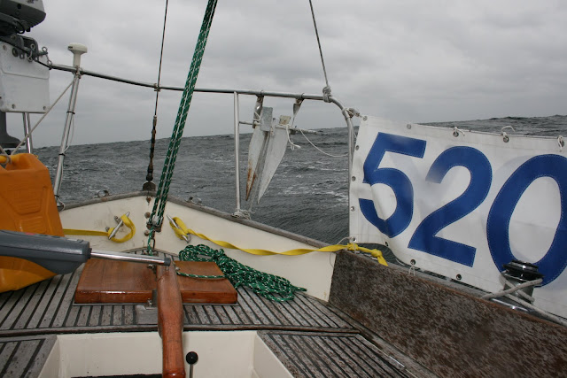
The only weather missing was snow.
Joy and I sailed out of Sippican Harbor, bound for Cape May as our first stop, under sunny skies about noon on Wedensday, 14 October, a little behind schedule but happy to be finally on our way, especially because a moderate NW breeze on our starboard beam was pulling us along nicely at about 6 knots. By the time we passed Cuttyhunk and the Buzzards "tower" at dusk, however, a high thin overcast had moved in, with lower scudding clouds below them. Portents of what we'd been told might develop...
We passed Montauk early in the morning on Thursday, under power for a while because the NW wind had faded during the night before building back by 0800 to 10-12 knots. It also veered N and then NE. We spoke with Susan Genett at RealWeather.com about 1030 and discussed options now that it was clear a strong nor'easter was fast approaching: Keep going to Cape May, turn back for Montauk (now about 20 miles behind us), or scoot to Sandy Hook and find a safe haven there. The first two choices didn't appeal to me at all, so Sandy Hook it was. (Susan strongly recommended against Cape May, preferred Montauk, but said Sandy Hook was ok since the strongest winds -- 35-40 knots, she predicted -- would be nearly right behind us).
The real wind -- now from the ENE off our starboard quarter -- began about 1100, building to between 30 and 35 knots where it stayed for the next 12 hours. There might have been gusts occasionally to 40, but nothing above that. Seas were 6-8', with perhaps a slightly higher swell every few minutes (every 7th wave?). For a while I worried we might get dumped on from behind, but Joy's canoe stern rose up as the waves passed under us, and we picked up speed and slid down the waves face before it passed on ahead of us. "Garmine," our Garmin 182C GPS, said at those moments we were flying along at just over 9 knots. A Nantucket Sleighride! Average speed from 1100 that morning to 2300 was 7.2 knots. Not bad under staysail alone...
I stayed below most of the time, poking my head out to check the boat and horizon every 15 minutes or so. I guess it's not surprising we never saw another boat or ship until we got near the approaches to New York Harbor, perhaps 5 miles from Ambrose Light. Only a damn fool would be out sailing in this stuff!
The ride below was surprisingly comfortable, however. I was able, for instance, to heat up some really good chunky soups, toast some bread, and boil water for tea and cocoa. The only problem was the cold (temp was about 45 degrees), but heating the soup helped, and thereafter I turned on both propane burners once an hour or so for about five minutes, and that kept the cabin relatively cozy.
We saw our first traffic -- a large, well lit cruise ship -- at about 2230 off to port as it steamed out of New York Harbor. As we approached Ambrose Light, other ships appeared, coming in and out of New York. Several very large tankers were also anchored neat Ambrose, presumably waiting for their pilots or for berths to open in the harbor. All of them were very brightly lit, making it difficult to see Ambrose Light and the other lighted buoys. Thank God for GPS, which told me where they were relative to Joy.
Aside: Those who think we can get along without the federal government and its infrastructure apparently have never thought about the usefulness of things like GPS and the military satellites on which it depends, Loran, or the Air Traffic Control system. It would be utter chaos at sea and in the air. We wouldn't have the Interstate system, Conrail, or Amtrak either.
Which reminds me of the scariest part of that night at sea approaching New York. About 30 minutes before sighting the lights of New York and the ancored ships, strange flashing lights began appearing in the clouds ahead of me every few minutes, and I couldn't figure out what I was seeing. UFOs coming to get us? Yikes! It wasn't lightning. Strobe lights from shore or a ship?
It wasn't until we were very near Ambrose that suddenly bright strobes, landing lights, and huge aircraft landing gear suddenly dropped out of the clouds about 500 feet directly above Joy's mast. Scared me half to death at first! But of course: Runway 50 at JFK is only a mile or two northeast of Ambrose, and these were commercial aircraft on their final approaches. Whew! Those planes were coming in every three or four minutes, even late at night. Busy airport...
So we passed Ambrose, entered the outer channel to Sandy Hook, and about midnight bore off to the south into Sandy Hook Bay. The seas flattened out, the wind abated somewhat now that we wer in the lee of Sandy Hook, and now it was our diesel's ("Iron John") turn to help the little staysail reach down the bay. After looking for protected anchorages up under the eastern shore and not finding anything suitable, we continued three miles south to Atlantic Highlands at the head of the bay to check out what looked like a good spot behind a jetty of some sort. Wow! we came around the light at the end of the jetty, and there was not only a protected anchorage, but a marina, a yacht club with marina, and several empty moorings! We picked up one of those, got out of wet foul weather gear, ate the last of the warm soup, and crashed -- glad and grateful to be safe, and very grateful to designer Chuck Paine for an amazing little cutter named Joy.
More to come....


